Crêts du Pilat's path
A must-see: listed as part of France's landscape heritage since 2015, the Crêts du Pilat offer hikers unparalleled views of the Alps and the Massif Central. Imagine yourself in the middle of winter, walking above a sea of clouds... A moment suspended in time, where the beauty of the great outdoors intoxicates you, and you almost forget to go home.
10km - 3 hours - Moderate difficulty

Chemin de Volan in Malleval
Malleval, “the bad valley,” the old stones of this small “Village of Character” rub shoulders with the terraced vineyards on impressive slopes. This is the land of Condrieu and Saint-Joseph wines, with a Mediterranean atmosphere where cicadas sing in summer among the hackberry trees and prickly pear cacti. In spring, make sure you wear sturdy shoes and take a detour to see the “Saut de Laurette” waterfall!
4km - 1 hour 30 minutes - Easy difficulty


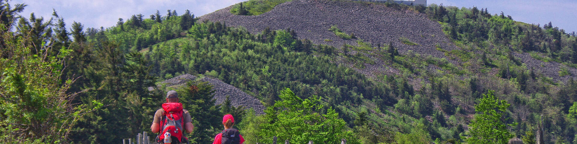
Crêt de Chaussître's path
The last major peak in the Pilat highlands, Crêt de Chaussître is the place to go for its panoramic views. Near its monumental cross and orientation table, you can see 37 church steeples! With landscapes of heathland covered in broom, false heather, and blueberries, all seasons are ideal for climbing it.
12km - 3.5 hours - Moderate difficulty

Path of Grand(e)s Cru(e)s
The walk begins in the Île du Beurre Nature Reserve, a true refuge for birds and beavers of the Rhône, which can be observed from several designated viewing points.
Then it's time to climb through the terraces of Côte Rôtie, emblematic of the local wine-growing landscape. The slope is steep, but the effort is quickly forgotten when you arrive at your destination: in the heart of the village, a panoramic viewpoint awaits you, offering spectacular views of the Rhône Valley. Throughout the walk, interpretive panels enrich the visit, making it as beautiful as it is informative.
3km - 1 hour 30 minutes - Easy difficulty


Saut du Gier's path
This short hike takes you to the heart of a mountainous valley, to the Saut du Gier waterfall. A thin stream in summer, it becomes spectacular in spring or fall when the flow increases.
From the hamlet of La Scie du Bost, a pretty, sometimes steep trail winds through a forest of majestic fir trees. The climb is challenging, but the scenery, with its rocks, steep slopes, and alpine atmosphere, is well worth the effort.
When you reach the foot of the waterfall, you'll be amazed by the power of the place: an impressive mineral site dominated by the largest chirat in Pilat. It's one of the most beautiful, wild, and unspoiled places in the massif.
3km - 2 hours - Moderate difficulty


Panère and Tourbières of Gimel
This beautiful trail is worth a detour to the summit of Panère: on a clear day, especially in winter, the orientation table offers an exceptional panorama. On your way back down, don't miss the Gimel bog trail, created by the Pilat Regional Nature Park to help visitors discover the richness of this unique environment.
A true refuge for many rare and protected species, the bog reveals its secrets along an educational and accessible trail. The Gimel bog has also been awarded 1 star in the Michelin Green Guide since 2023 - a wonderful recognition for this natural gem.
11.5 km - 3.5 hours - Moderate difficulty

In the footsteps of the Carthusians
Set off on foot from the village of Pavezin, nestled among schist farms and rolling hills, for a beautiful and charming loop trail. The path leads you through woods and meadows to an exceptional site: the Chartreuse de Sainte-Croix-en-Jarez, nestled in a green setting.
A former monastery converted into a village during the Revolution, Sainte-Croix-en-Jarez is now listed as one of the Most Beautiful Villages in France. A unique immersion in the history of the Carthusians.
6 km - 2 hours - Very easy difficulty


The Ardèche's path
Perched at an altitude of nearly 900 meters, Burdignes lives to the rhythm of its farms and wide open spaces. Far from the main roads, this lively village offers a real breath of fresh air. Here, the landscapes stretch as far as the eye can see: on one side, the Pilat mountains, on the other, the blue silhouettes of the Ardèche mountains. The balcony trails invite you to stroll, culminating in the Croix de Chirol orientation table, which offers a magnificent 360° panorama.
Tip: avoid this route in hot weather as there is little shade.
10 km - 3.5 hours - Moderate difficulty


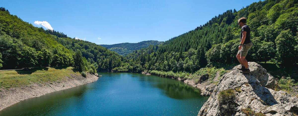
Le Tour des Barrages
An unmissable hike from the village of Charles Exbrayat to discover Saint-Étienne's hydraulic heritage. Two dams, two atmospheres, and a visionary construction for its time! The Gouffre d'Enfer dam, already designed with walkers in mind, is a true architectural success that blends perfectly into the green and mineral landscape.
9 km - 3.5 hours - Moderate difficulty
Mount Monnet
The start of this beautiful hike is a little steep, but your efforts will quickly be rewarded with your first unobstructed view of the Lyon region. The shaded trail then leads you to the Croix de Longes, before descending towards Renmilleux and the Col de Grenouze. This is where the climb to Mont Monnet begins, a little-known, almost forgotten peak that has a big surprise in store. On a clear day, the view from the summit is simply stunning. The Rhône river stretches out below like a wide blue ribbon, while the Pilat mountains stand out on the horizon.
Take the time to pause and contemplate. The orientation table will help you identify the surrounding peaks... and perhaps inspire your next hikes.
9.5 km - 2 hours 45 minutes - Moderate difficulty

